Your Hub for Climbing in Bishop, CA
The Sierra's Ultralight Backpacking Authority
Run the Range of Light
Train With Us
-

Mountain Inspired Designs
Sage to Summit is here for all your Sierra inspired apparel. We've...
-

Books & Maps
Looking for guidebooks for local bishop hikes, climbs, runs, or boulders? We've...
-

Ultralight Backpacking
We've got the best ultralight packs in Bishop! Come check out our...
Gear Rentals
-
Flashed Big Squishy Crash Pad Rental
Regular price $10.00 USDRegular priceUnit price / per$0.00 USDSale price $10.00 USD -
Sleeping Bag Rental
Regular price $12.00 USDRegular priceUnit price / per$0.00 USDSale price $12.00 USD -
Tent Rental
Regular price $20.00 USDRegular priceUnit price / per$0.00 USDSale price $20.00 USD -
Weekender Bearikade Canister Rental: IN-STORE Pick-Up
Regular price $6.00 USDRegular priceUnit price / per$0.00 USDSale price $6.00 USD -
Weekender Bearikade Canister Rental: Ship to Me
Regular price $6.00 USDRegular priceUnit price / per$0.00 USDSale price $6.00 USD -
Backcountry Ski Rental Package
Regular price $65.00 USDRegular priceUnit price / per$0.00 USDSale price $65.00 USD
Mountain Resources
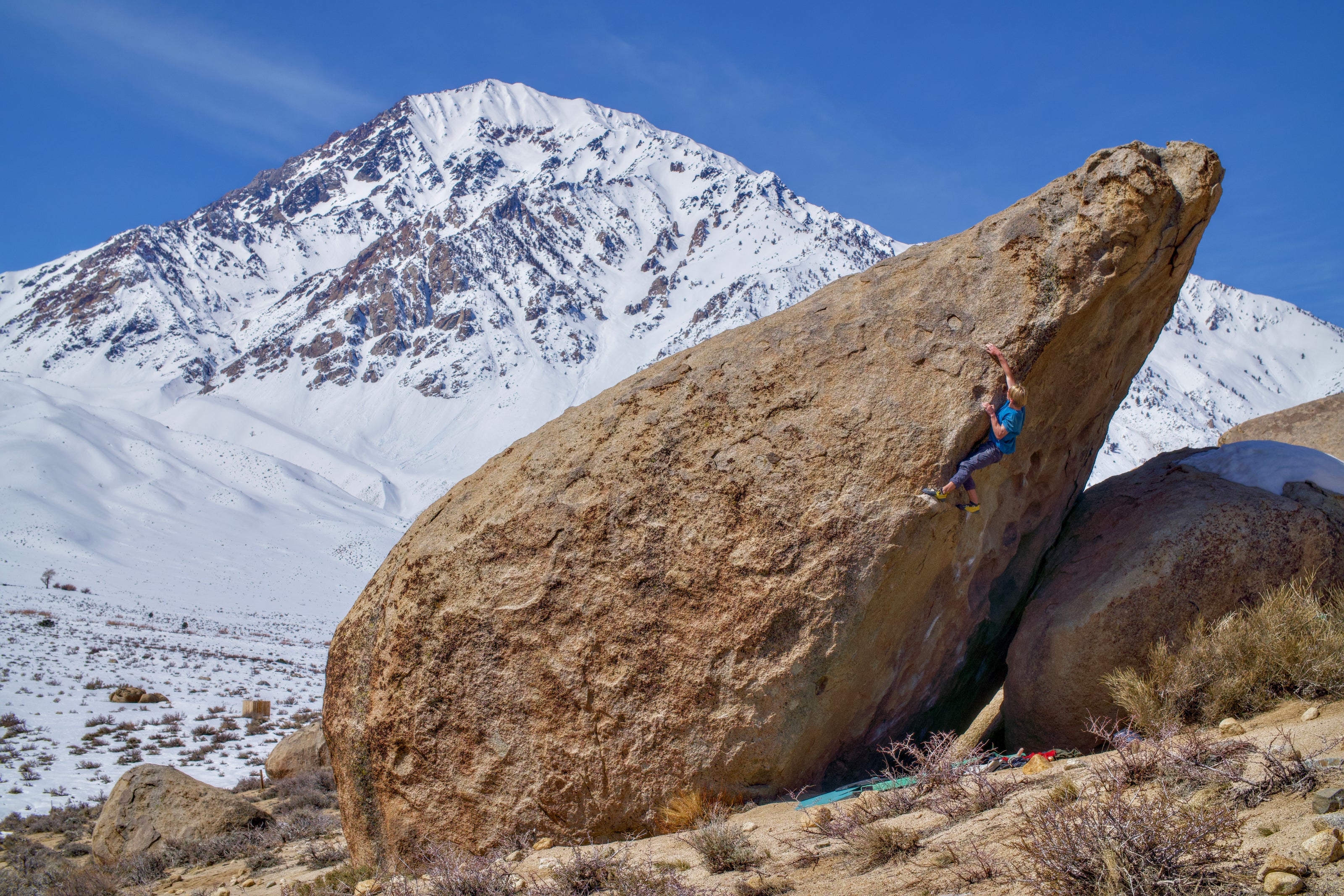
BISHOP BOULDERING PRIMER

Let us be the first to welcome you to beautiful Bishop, CA in the Eastern Sierra. We think this is one of the greatest places on Earth. We have prepared some information for you that will make your life a little bit easier so you can spend less time planning and more time enjoying the wonderful, outdoor activities that attracted you here in the first place.
Weather
The first thing to know a bit about is the weather. Bishop is in the high desert of California; this means that the weather, while generally sunny and dry, can still swing in some different ways. First of all, Bishop is at 4000 feet (1260 meters), with the Buttermilks nestled even higher than that. As such, the sun beats down pretty hard, so sunscreen is advisable. This also means that, generally, if it is sunny, it is likely to be warm. However, because it is the high desert, nights will often get very cold, down to freezing and below. Please plan accordingly! Sage to Summit rents tents and sleeping bags if you find you need more camping gear. Another factor to consider is the wind. Often, the wind is more of a hindrance than rain, as Bishop averages more than 300 days of sunshine a year. The wind is generally an issue in the Buttermilks, where the elevation and proximity to the mountains can allow for some howling days. The Tablelands (Happies and Sads), on the other hand, are lower and in more protected canyons.
Camping
There are a variety of camping options in Bishop, CA. Much of the land surrounding the town is either BLM or National Forest land; this means you are allowed 2 weeks of free camping a year here, including up at the Milks and in the Tablelands above the Happies and Sads. The local ranger station, on Main Street, has maps detailing where BLM and NF land are. If you choose to camp for free, please be aware that this is a privilege, not a right; if we climbers do not take care of the environment in which we recreate, this option will not be there in the future. Please camp only in already established spots (don’t just drive off the road anywhere to set up), please clean up after yourself, and PLEASE, PLEASE, PLEASE be careful with campfires. The area is incredibly dry, and fires happen quickly, especially on windy days. Better yet, do without a fire! If you do wish to have a fire, permits are required and can be found here for free.
There are also a number of paid camping sites surrounding Bishop. The Pit, a BLM campground near the Tablelands, is popular with climbers for its affordable price ($5/night per site). Click here for more information. The Bishop Visitor website outlines the various campgrounds of varying levels of cost and facility here. The Bishop Climber's Coalition has created a map with camp grounds and public lands toilets here.
Finally, if you need a little more comfort than camping offers, the Bishop Hostel, the Eastside Guesthouse, and Airbnb are worth checking out.
Amenities
Bishop, while small, has everything you need to enjoy your trip. Below are just a few of the local necessities and favorites.
Groceries
Bishop hosts four grocery stores, three large and one local. Vons carries everything you can expect from a large chain supermarket. Smart & Final has a bulk section that can be useful. Grocery Outlet carries cheaper products, though less of a selection. Finally, Manor Market is a small, local shop that sells local produce and meat, as well as the best beer selection in town.
Restaurants
The following establishments are some of our favorites here at Sage to Summit:
The Mountain Rambler - locally brewed beer, good food, and a music schedule worth checking out. Wifi. Gluten free, vegan/vegetarian, and non-alcoholic options!
Black Sheep - the original Bishop climber coffee shop. Wifi.
Taqueria mi Guadalajara - Amazing Mexican food from a bright yellow taco truck!
Salsa's Taqueria- also amazing Mexican food if you want more of a sit down vibe.
Great Basin Bakery - Stuffed croissants and the best sourdough in town!
Thai Thai - out at the airport, but worth the drive out of town even if you don’t plan to fly. BYOB.
Salt - A cute little cafe in a converted Airstream trailer! Located in front of the Eastside Guesthouse.
Showers
There are a few options for showers in Bishop:
Hostel California and Eastside Guesthouse - $5 and both take cards.
Keough Hot Springs - a bit pricey and south of town, but full service and nice.
Wifi
All the coffee shops in town have Wifi. Pick your caffeinated poison.
Water Fill Up
You can fill up your water at the Speedway Express on 395 just south of town. The spigots are in the back with the dump station. This is also a great place to wash and vacuum your car.
Propane Fill Up
Ace Hardware will fill up your propane tank for a reasonable price, and often has the small green containers for sale. You can also usually find the green containers at Vons, Eastside Sports, and some of the various gas stations.
The Climbing

One of the wonderful things about climbing in Bishop is that the 2 main areas, the Buttermilks and the Tablelands, are distinct in rock type and style. Generally, no matter what you are into, there is some climbing here for you!
Area Ethics
Following area ethics goes a long way towards keeping a good relationship with the locals! We love and care for our area dearly, and we would appreciate if you did too. Because we are in a high altitude desert, our environment is EXTREMELY slow to recover from damage, if it ever does. We are talking decades to centuries from seemingly innocuous acts like walking off trail, accidentally running over sage brush, surface pooping/cathole digging. That said, practicing Leave No Trace is absolutely essential! Our wonderful climbing rangers work hard to preserve our climbing areas, but they can only do so much and frankly, it shouldn't be their job to clean up after you.
PETROGLYPHS--Please only climb on developed rock! If you aren't used to this area, it can be really hard to tell when you are climbing on a petroglyph or on an ancient Native living quarter. Most of the time, these areas are not marked as to avoid attracting more foot traffic. Don't be that guy who destroys a 10,000 year old artifact because you think you're getting a first ascent. Check out the Paiute-Shoshone Culture Center to learn more.
PARKING--Please only park in designated areas! If you have to park farther away and walk, do that and consider it your warm up. Don't park in front of access trails so that people have to step off trail to get around your car. Don't park in such a way that it creates a one-way bottleneck--if a large emergency service vehicle can't get past your car, you are endangering yourself and everyone around you. Please don't park on plant life--those bushes might look dead, but in the warmer months they spring to life and are essential for life to birds, insects, lizards, deer, and desert rodents. Fun fact--because sage brush grows so slowly, those bushes you see are likely over a hundred years old!
Finally, the 25mph speed limit might seem arbitrary, but it's actually essential to keeping dirt road in shape. Hate driving over all that washboarding? Well, they're caused by people driving too fast!
POOPS--As mentioned, wags bags are the way to go. Worst comes to worst, pick it up with a doggy bag, stash it under your windshield wiper, and throw it away when you get in town. Embarrassment is temporary, having your dog dig it up and eat it and lick your face is forever!
STAY ON TRAIL--This is super important! Like we said, the desert is slow to recover and our climbing areas take a real beating in winter from traffic. PLEASE pay attention to signage, look twice to make sure you're on a rock-lined designated trail rather than a social trail, and make sure you aren't draping your stuff all over bushes and plant life.
VOLUNTEER--The climbing rangers host a monthly stewardship event where you can learn how to do trail work properly, methods of conservation, and help keep the areas you climb in looking spiffy. We love love love it when folks who come to visit carve out a few hours of their trip to give back!
The Buttermilks
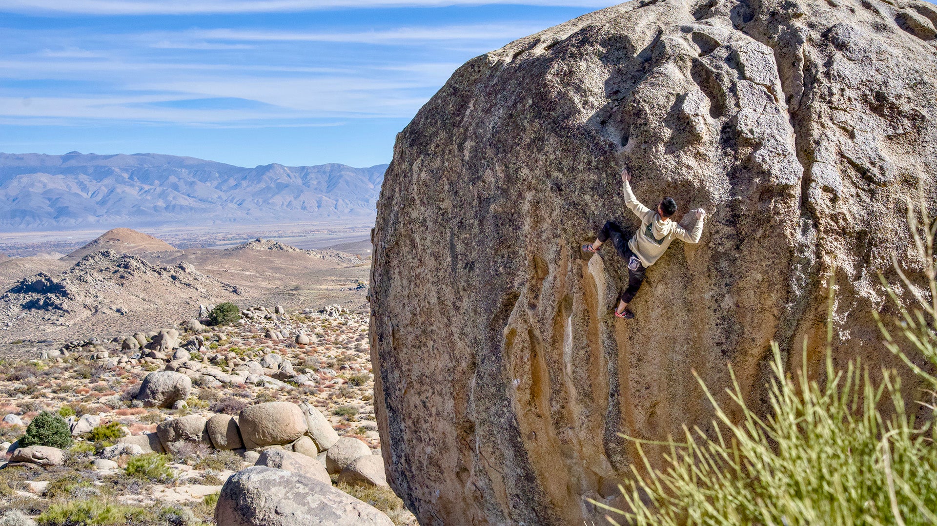
Known for huge blocs and amazing views there are few bouldering areas in the world as picturesque as the ‘Milks. The rock here is a form of granite called quartz monzonite; the climbing trends towards the tall, the technical, and the crimpy.
Best Warm Up Area
There are basically two options for warming up in the Milks. The first is at the southern end of the boulder field on the north side of Grandma Peabody (that’s the MASSIVE boulder behind the first MASSIVE boulder you see when driving up). This overhanging face has a number of good, juggy, drops offs as well as some crimpy lines to get your fingers ready. The other option is on the North end of the field at the Birthday Boulders. These tend to be more vertical and technical warm ups.
Classics
Hero Roof v0
Buttermilk Stem v1
Green Wall Essential v2
Birthday Direct v3
Iron Man v4
Go Granny Go v5
Saigon v6
High Plains Drifter v7
Flyboy Sit v8
Soul Slinger v9
Stained Glass v10
Evilution v11 (v10 to the lip)
The Mandala v12
The Buttermilker v13
The Tablelands
The Happy Boulders and the Sad Boulders, the two main areas in the Tablelands, are so different in feel and style from the Buttermilks that they might as well be on a different planet. Where the ‘Milks are thin and techy, Tableland climbing tends towards the steep and physical. Expect big moves, steep climbing, and some pockets as well. The Happies is perfectly named; more open than the Sads, there is a ton of climbing here in every grade. The Sads tends to have the harder stuff, and there is less of it. Both are definitely worth checking out! Be warned--you should ONLY use the Chalk Bluff Road entrance to the Sads. Any other road is very rough, and uses a private road that leads to a private residence.
Best Warm Up Area: Happies
The very first major sector you come up to in the Happies, the Rave Cave/Acid Wash has a number of excellent warms up and climbs from v0 all the way into the double digits. Another option is Central Happiness near the Hulk and Solarium. This sector has less easier stuff, but, being central, makes it easier to access the majority of the climbing here.
Classics: Happies
Celestial rail v0
Heavenly Path v1
Monkey Hang v3
Ketron Classic v4
Solarium v4
Serengeti v5
The Hulk v6
Acid Wash Right v7
Disco Diva v8
Acid Wash Right Sit v9
Acid Wash Left Sit 10
Kill On Sight v11/12
Best Warm Up Areas: Sads
The best warm up area in the Sads is in the very back, near the entrance to the Ice Caves. Here, there are a number of short and easy lines to play on, as well as some short and steep ones to get those big muscles ready for thuggin’ through some caves.
Classics: Sads
China Doll v0
Kipper Snapper v1
Prozac Nation v2
Spacesuit v3
The Fang v4
Strength in Numbers v5
Rios Crack v6
Lawnmower Man v7
Pow Pow v8
Slunk v9
Beefcake v10
Wheel of Beef v11
The Aquarium v12
Respect the Wildlife
The rocks we love to climb are also the natural home of Panamint rattlesnakes. In the winter and spring, rattlesnake females depend on stable dens in the rocks where they stay warm with their sisters and care for their young. Please be mindful of your hands and feet while climbing. If you do see a snake or hear a rattle, give the snake a wide birth and go around.
Rest Days

Even though you may want to, climbing everyday is not really possible; rest is often the key to sending! Luckily, the Eastern Sierra is every outdoor enthusiast’s dream, so here are some ideas for what to do on the inevitable rest days.
Hikes
The are here is packed with beautiful and easy-to-access hikes. Regardless of the weather, there is almost certainly somewhere to go check out the natural beauty on display. Below are a few of our favorites, as well as links to more information:
Big Pine Creek North Fork Trail
This strenuous hike out Big Pine, just south of Bishop, offers those willing to go the distance access to seven incredible, glacier-fed lakes and views of the imposing Palisades. The first lake is about 5 miles in and the last lake about 7 miles, for a total trip of 10-14 miles. You can find more information here
The Beach
The ocean is pretty far from the eastside, but we still have our own version of a beach here. Located just North of Bishop in the white mountains, this white pumice beach makes for an easy 4 mile round trip hike and a great day out. As it is tough to find information online, here are some directions: take the 6 out of Bishop for 3.8 miles and then turn right onto Silver Canyon Road. After .4 miles, make a left onto Joe Smith Rd. !.3 miles gets you to Jean Blanc Rd., where you turn right and go for half a mile to a left on Churchill Mine Rd. After 1.06 miles, make a right onto a dirt road. Be careful here, as the road gets pretty rough. The parking is on the right at 2.3 miles. From the parking, hike up the road 1.1 miles to the beach! Keep your shoes on, as there are bits of wire and glass hidden in the sand. There is another beach .8 miles farther up the road; this one has less potential hazards.
Discovery Trail
One of the more amazing natural elements in the area are the ancient bristlecones, some of which are more than 4000 years old. The Discovery Trail is an easy hike, less than a mile round trip, that takes you through a grove of these trees that have been alive since before the Roman Republic began. For more information, go here.
Hot Springs
Due to the volcanic activity in the area, there are a number of hot springs within a short drive from Bishop that can be enjoyed, offering relaxing times and soothing heat for sore muscles. There are very few things as wonderful as a cold night under the stars warmed by the hot water and steam of a naturally fed hot spring. There are a number of free hot springs in the area; an internet search will get you the information you need. Be warned: nudity is a cultural norm at hot springs--be conscious of where you park and camp so as to allow for other's comfort and privacy at the springs.
There are also some paid springs; these are nice as they have other amenities on offer as well. Click here for more information.
Culture
Though small, Bishop is not bereft of local culture. If you like history, then there are some very interesting sights to see. Of special interest are the Paiute-Shoshone Cultural Center Museum and Manzanar National Historic Site. For more information on those, as well as information on some other museums and cultural sites in the are, go here.
Sage to Summit
Finally, we would like to let you know that we at Sage to Summit are here to help, be it by answering questions or by offering the products you might need to make your visit more enjoyable. Just so you know, here are some other things we offer that you might find useful:
Climbing Gym
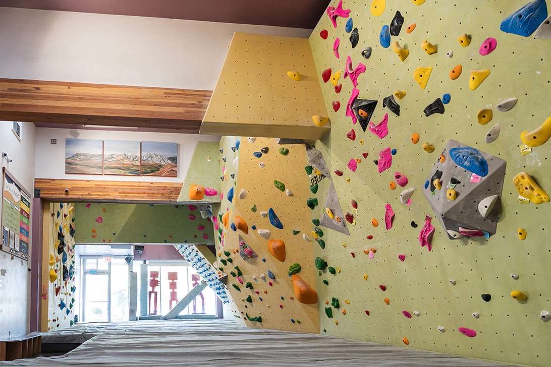
Sage to Summit has a full service climbing gym including frequently reset walls, an adjustable angle Moonboard, and a training room in the back with weights, hangboards, and more! Perfect for warming up for the project, for getting some more fitness in after a day of climbing, or for the occasional bad weather day, we hope you’ll come check it out. For photos and more information, check out our site here.
Rentals
We rent crash pads, guide books, sleeping bags, and backpacks.
Books
If you prefer to buy a guide book, we have them for sale as well!
Basics
We also carry all your climbing basics, from chalk, tape, brushes, pads, training tools, and skin care products.
We hope you consider coming to us should you need anything to make your trip more productive!
EASTERN SIERRA MOUNTAIN RUNS
Each run includes details about the run along with a downloadable map with extra information.
Interact with some of the runs on the dynamic map page!
List of Eastern Sierra Mountain Runs
Lake Tahoe
- Tahoe Rim Trail Fastpack (174 miles, 25000' gain, difficult)
Lee Vining
- Emigrant Wilderness Fastpack (75 miles, 13000' gain, difficult)
- Grand Canyon of the Tuolumne Fastpack (66 miles, 10550' gain, difficult)
- Parker Pass Loop (10 mi, 2,000 ft gain, moderate)
- Tioga Pass to Silver Lake (18 mi round-trip 3760 ft gain / 6110 ft loss, difficult)
- Tuolumne Vogelsang Loop (28 mi, 5,857 ft gain, difficult)
- Tuolumne to Agnew Meadows (24 mi, 1500' overall descent)
- Young Lakes Loop (12 mi, 2,141 ft gain, difficult)
Mammoth Lakes
- Agnew Meadows and 1,000 Island Loop (12 mi, 3,620 ft gain, difficult)
- Agnew to Silver Lake (21 mi, 3,660 ft gain, difficult)
- Agnew Meadows to Tuolumne Meadows (26 mi, 4,540 ft gain, difficult)
- Antelope Loop (7.6 mi, 760 ft gain, moderate)
- Deer Mtn Loop (5 mi, 400 ft gain, moderate)
- Duck Pass (7 mi, 1700 ft gain, moderate)
- Glass Mountains 25-Miler
- Green Church Loop (9.5 mi, 300ft gain, moderate)
- Mammoth to McGee Creek (28 mi, 5,720' ascent / 6555' descent, difficult)
- Mammoth Rock Run (5.2 mi, 580 ft gain, moderate)
- Shady Rest Hill Climb (7.8 mi, 725 ft gain & loss)
Tom's Place/Rock Creek/McGee Creek
- McGee Pass (18 mi round-trip, 4100 ft gain, difficult)
- Rock Creek to Crowley via Hilton Lakes (10.5 mi, 750 ft gain, moderate)
- Rock Creek to Pine Creek Via Muir Trail (51 mi, 10,170 ft gain, very difficult)
- Lower Rock Creek (16 mi, 2200 ft gain, moderate)
- Morgan Pass (8 mi, 1000' ascent/descent, easy)
- Mono Pass (7mi / 7.75 mi with Ruby Lake, 1800' ascent/descent, moderate)
Round Valley
- Round Valley 6 Mile Loop (6 mi, 200 ft gain, easy)
- Round Valley 9 Mile Loop (9.2 mi, 250 ft gain, moderate)
- Pleasant Valley Loop (7.8 mi,800 ft gain & loss, moderate)
Bishop
- EastsideTrails Overview
- Bishop Canal (various distances, easy to moderate)
- Bishop Creek Pipeline Rds & Edison Loop (15.5 mi, 3,160 ft. gain, difficult *you can modify the run to suit your training). More info here
- Bishop Pass (10 mi, 2,180 ft gain, difficult)
- Black Canyon (15 mi, 3,180 ft gain, difficult) *this is an out-and-back so you can shorten or lengthen the run
- Black Canyon to Redding Canyon (20 mi, 4730 ft gain/loss, difficult)
- Coyote Ridge (20 mi, 6,500 ft gain, difficult)
- Druid Stone Grunt (3 mi, 1640 ft gain, difficult)
- Druid Trail to Rawson Creek Trail Loop from Warm Springs Rd (14 mi, 3300 ft gain, difficult)
- Evolution 100K (55 mi, 9,800 ft gain, very difficult)
- Fish Slough Half-Marathon Loop (12.89mi, 400ft gain, moderate) for more info click here
- North Lake to Pine Creek aka The Sky Marathon (26 mi, 3,805 ft gain, difficult)
- Pilot Knob & French Canyon Alpine Lakes Fastpack (27 miles, 5455' gain/7235' loss, difficult)
- Piute Pass - 10 miles roundtrip 1800' Up (10 mi, 1,800 ft gain, moderate)
- Sheepherder 20-mile Loop (20 miles, 2260 ft gain, moderate)
- South Lake to Big Pine Creek (13.5 mi, 2822 ft gain / 5042 ft loss, difficult)
- Tungsten Hills Half-Marathon (13 mi, 1,400 ft gain, difficult)
- Tungsten Hills 10-mile Loop (10.1 mi, 1,200 ft gain, moderate)
- Tungsten Peak 10K (7 mi, 1,500 ft gain, difficult)
- Tyee Lakes and Table Mt (5.8 mi, 2,890 ft gain, moderate)
- White Mountains Fastpack (61 miles, 18200' gain, difficult)
Big Pine
- Big Pine to Fourth Lake (12 mi, 3,200 ft gain, difficult)
- McMurray Meadows Loop (12 mi, 1800 ft gain, moderate)
- Papoose Flat Loop (23 - 25 mi, 3,400 ft gain, difficult)
- Red Mountain (5.8 mi, 1034 ft gain, moderate - starting at Tinemaha Campground) View scree running on Red Mountain
Independence
- Kearsarge Pass (8 mi round trip 2600 ft gain, difficult)
- Taboose Pass (14 mi round trip, 6000 ft gain, difficult)
- Pat Keys Trail (12 mi round trip 11,500 ft gain, difficult)
Lone Pine
- Horseshoe Meadow Loop (20 mi, 3,900 ft gain, difficult)
- Mitre Basin Fastpack (50 miles, 15475 ft gain, difficult)
- North Fork of Lone Pine Creek Fastpack & Mountain Climb ( 48 miles, 19000' gain, difficult)
- Titus Canyon (26.2 mi, 2325 ft gain / 5570 ft loss, difficult)
WHAT IS MOUNTAIN RUNNING
Running is a means of terrestrial locomotion allowing humans and other animals to move swiftly on foot. Mountain Running is a discipline of long-distance running that takes place in mountain topography. Mountain Running can be defined by two philosophies: 1) the appreciation of the joy and benefits of moving rapidly on foot through natural mountain landscapes, and/or 2) the athletic pursuit of the fastest possible speed on foot over a given mountain route, given considerations of risk and safety.
As with normal running, two feet leave the ground at regular points in the gait, however mountain running may also employ techniques of walking, scrambling, climbing, hopping, jumping, skipping, leaping, sliding, glissading, wading, post-holing, bushwhacking, and swimming for short distances. Mountain runners strive to apply the most efficient technique to the terrain and conditions while also taking into account their own personal capabilities and preferences.
Although mountain running can be done on asphalt or dirt road surfaces, this activity is more often enjoyed on established mountain trails or in rugged terrain where such trails do not exist. Mountain Running activities typically start and finish from points in civilization such as a road, trailhead, lift station, basecamp, or lodging facility and do not require an overnight bivouac in the mountains. Mountain Running activities can be organized competitive athletic events or casual personal outings. Navigation, route-finding, survival, self-sufficiency, and general mountain sense are important skills for long distance Mountain Running, especially outside of organized and supported race events.
Some Mountain Running itineraries may demand certain mountaineering skills and very lightweight mountaineering equipment. Mountain Runners may use specialized crampons that work on lightweight footwear or a small aluminum ice axe for short snowy sections. The following are generally considered to be outside the realm of Mountain Running: planned multiday journeys carrying bivouac or camping gear, use of a rope, harness, or other climbing security hardware; use of skis, snowshoes, watercraft, or other modes of travel not by foot; terrain that prevents one from achieving steady, rapid, forward progress, such as difficult rock climbing terrain, glacier obstacles/hazards, dense brush, etc.
Relatives of Mountain Running:
Trail Running - Specifically related to running on trails. Trail Running may or may not be done in mountain topography. Mountain Running outings usually involve a significant amount of Trail Running but travel may or may not be exclusively on trails. The term Trail Running typically refers to the running surface more than the topographic setting or context of the activity.
Ultrarunning - Also known as Ultramarathoning. Describes running distances longer than a marathon (26.2 miles). Organized ultrarunning race events known as ultra distance races or ultras, for short, are common and growing in popularity. These races are usually a minimum of 50 kilometers (31.07 miles). Ultrarunning may or may not be organized as a competitive event, and may or may not involve mountain topography. Most Ultrarunners train for and participate in competitive long-distance running events.
Skyrunning - Skyrunning is a racing discipline of Mountain Running that takes place above 2,000m where the incline exceeds 30% and the climbing difficulty does not exceed II° grade. Ski poles and hands may be used to aid progress. The International Skyrunning Federation was formed in 2008 in Italy and most Skyrunning race events are in Europe, but there are also major events held in the Americas and Asia.
Fell Running - Fell Running is a historical predecessor to Mountain Running. Fell running races started in the fells and hill country of Northern Britain's Lake District, which first gained widespread popularity in the 19th century. The tradition of these races continues today. These are generally adventurous competitions that, in addition to running in rugged, and sometimes boggy terrain, may demand skills in navigation, orienteering, and sometimes require carrying specified survival equipment. These events exclude any rock climbing or travel on loose, unstable slopes. Outside of these races and the United Kingdom, this term is rarely used for similar Mountain Running endeavors elsewhere.
Cross Country Running - Cross Country Running is an athletic racing event that has its origins in prehistoric times. It was first formalized into national competition in Britain in 1876 and International Championship competition in 1903. Running surfaces are generally earth (e.g. trail, dirt road) or ideally grass, and race courses are well marked. Courses are a standard of 5 meters wide to allow passing and are usually between 1.75 and 2km long, featuring rolling hills with smooth curves and short straights.
Adventure Racing - A descendant of Mountain Running racing, Adventure Racing combines at least 2 different endurance disciplines typically including: Trail or Mountain Running, Fastpacking, orienteering, navigation, mountain biking, paddling, climbing, and/or technical ropework. Sometimes races include such unconventional modes as: in-line skating, paragliding, horse/camel riding, caving, canyoneering, and more. Races are team events of various lengths, lasting from a few hours to several days.
Peak Bagging - Peak Bagging is a term for mountain climbing where the principal goal is to reach the summit or a specific set of summits. A difference between Peak Bagging and regular mountain climbing is that in Peak Bagging the summit is usually one of multiple high points of prominence on a list that one has made it a personal goal, or perhaps obsession to achieve. These lists may be published or self-generated, but either way, Peak Baggers tend to make "bagging" the summits on their lists the primary reason for going to the mountains. Routes and styles are secondary to the goal of simply standing on the top. Regional mountain clubs generate many of these peak lists. The "Seven Summits" a list of the highest peaks on each of the seven continents is among the most infamous examples, as is the "State Highpoints" list and the "14'ers" lists in the U.S., and the 4000m peak list in the Alps. The term Peak Bagging can also apply to lesser peaks that typical hikers and Mountain Runners can ascend to without technical skills and equipment. Mountain Runners sometimes take up Peak Bagging as a speed challenge with a summit highpoint, or in an effort to summit as many nearby peaks as possible in a single outing or ridge traverse.
Speed Climbing - Speed Climbing can be defined as climbing technical snow, ice, and/or rock routes as quickly as possible in a very lightweight style. Technical climbing terrain is loosely defined as 4th class rock climbing / UIAA grade III / French PD or harder. Aid climbing is also considered technical. This activity poses significant risks due to critical dependence on personal skill and abilities, and generally little margin for error if anything goes wrong. Terrain is often highly exposed to mountain hazards such as falling, rockfall, icefall, avalanche, crevasses, and mountain weather. Speed climbers generally try to avoid standard safety systems to decrease weight and increase speed. Less time on a mountain route can reduce the overall exposure time to risk, which in many cases makes climbing slowly with increased safety systems riskier than climbing quickly and continuously without them. Successful Speed Climbing requires a very high level of skill and confidence to move efficiently in technical terrain, as well as a willingness to accept the risks of climbing without conventional safety systems.
Leave No Trace
World Mountain Running Association - http://www.wmra.ch/
International Skyrunning Federation - http://www.skyrunning.com/
International Association of Athletics Federations on Mountain Running - http://www.iaaf.org/community/athletics/mountainrun/index.html
International Association of Athletics Foundations on Cross Country Running - http://www.iaaf.org/community/athletics/crosscountry/index.html
International Association of Ultrarunners - http://www.iau.org.tw/
ultraRUNNING Magazine - http://www.ultrarunning.com/
Fell Runners Association - http://www.fellrunner.org.uk/
Mountain Running, Salomon - http://www.salomonrunning.com/us/
Mountain Running, The North Face - http://www.thenorthface.com/en_US/brand/running
Mountain Running, La Sportiva - http://www.mountainrunning.com/
Trail Running and Ultras - http://www.irunfar.com/
United States Adventure Racing Association - http://www.usara.com/
Peak Bagging - http://www.peakbagger.com/
Speed Climbing - http://speedclimb.com/ & http://www.himalayaspeed.com/
Fastpacking - http://www.backpackinglight.com/ & http://www.backpacking.net/index.html
Speed Records - http://fastestknowntime.proboards.com/index.cgi?board=mountains
Guided Fastpacking and Mountain Running - http://www.sierramtnguides.com/
Trail Runner Magazine - http://www.trailrunnermag.com/index.php
Backpacker Magazine - http://www.backpacker.com/
Alpinist Magazine - http://www.alpinist.com/
Adventure World Magazine - http://www.adventureworldmagazine.com/
Sage to Summit - Frequently Asked Questions
Fastpacking - see What is Fastpacking?
WHAT IS FASTPACKING
Fastpacking is a cross between Backpacking and Mountain Running. The defining characteristics of Fastpacking are: 1) Rapid, long-distance mountain travel, on foot, over multiple days, involving camps or bivouacs, and 2) Refined equipment choices and practiced skill sets that allow for both rapid movement and self-sufficiency in a remote mountain setting. Fastpackers share alpinists’ “light and fast” attitude for moving in the mountains. Fastpackers use gear selection, ingenuity, and a streamlined approach as primary tools for maximizing speed and minimizing overall effort, without overly compromising safety or comfort.
Fastpacking Informational Videos
Resources for Fastpacking:
Mountain Running - see What is Mountain Running?
SIERRA EVENTS CALENDAR

Our winter race series is back!
All races start at Millpond County Park.
Check in at 8am, race at 9am.
5k
December 14th benefits the Bishop FC. - Race Results
January 11th benefits the Eastside Student Center.
February 8 benefits Wild Iris.
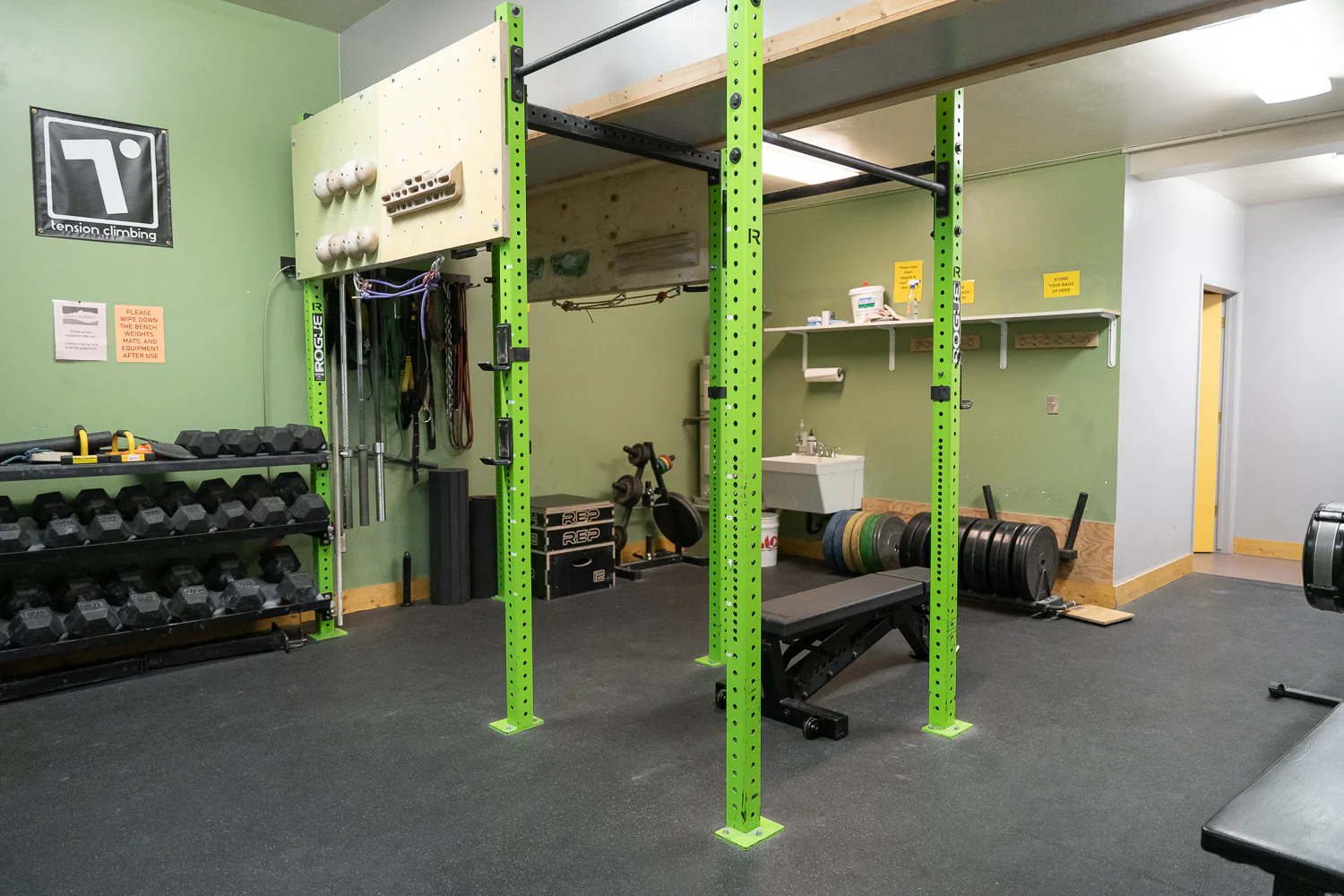
Reserve Your Spot In the Weight Room
The weight room fits three people working out and one person on the treadwall. Reservations are in one hour time blocks.


